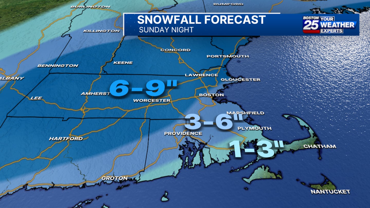
SUNDAY SNOWSTORM
After sunshine early Sunday, clouds take over this afternoon ahead of a winter storm. It’s still warmer this afternoon with highs in the low 40s. Snow will arrive between 4-6pm, with rain initially falling across eastern Massachusetts. A Winter Storm Warning has been issued for much of Massachusetts and southern New Hampshire from 1 PM today until 7 AM Monday. In this area, we’re expecting snow accumulations of up to 9 inches, so plan accordingly, especially if you’ll be traveling later today or into the evening.
For those along the South Shore and South Coast, a Winter Weather Advisory has been posted from 1 PM today through 7 AM Monday. This region will see a mix of snow and rain, with snow totals likely closer to 3 inches. The Cape and Islands are expected to see mainly rain, though there will be a quick burst of snow as the storm moves out overnight.
Although it will be breezy tonight, wind is not expected to be a major concern with this storm. However, the combination of snow and rain could make for slick roads and poor visibility, so be cautious as you venture out.
ARCTIC CHILL AHEAD
Once this storm moves out, we’re in for some serious cold. Behind the storm, a blast of arctic air will sweep through the region, dropping temperatures dramatically. We’re looking at highs only in the teens on Tuesday and Wednesday, with morning temperatures dipping into the single digits. Factor in the wind chill, and it could feel well below zero, so make sure to bundle up if you’re heading outside.
Stay with us as we continue to track the snow and the cold this week!
© 2019 Cox Media Group


