MONDAY SUNSHINE
Grab your sunglasses and a warm coat. It will stay bright and blustery today with gusts 20-30 mph. Highs will reach the lower 30s but feel 10 degrees colder because of that wind.
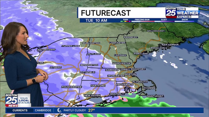
TUESDAY WEATHER ALERT
The morning commute looks fine Tuesday morning. Light snow will arrive late morning or midday. It will persist through the afternoon and evening, with some melting and mixing along the coast, and especially on Cape Cod where any early coating will be washed away. The rest of the area will see a coating 2″ with the highest totals north and west of I-495. The Berkshires, Green, and White Mountains will see a tad more.
CHRISTMAS EVE & DAY
Wednesday looks dry for Christmas Eve, with temperatures gradually dropping. Christmas Day looks seasonably cool with the chance for light snow and flurries in the morning north of Boston. It really doesn’t look substantial, with just a patchy dusting. The afternoon looks dry and mainly cloudy.
We’re keeping an eye two more potential storms. The first is late Friday into Saturday much colder weather and snow. It’s too early for projected snow totals, but it won’t be a double digit snow storm. Then Sunday looks to warm up with rain overnight into Monday. Remember, storms can shift so be sure to check back as we fine tune timing and details.
© 2025 Cox Media Group
/cloudfront-us-east-1.images.arcpublishing.com/cmg/7QOJU3BNCJERBNKJC5LWTBYFLU.png)