BOSTON — A nor’easter will bring snow, strong wind gusts, and possibly coastal flooding to Massachusetts on Tuesday.
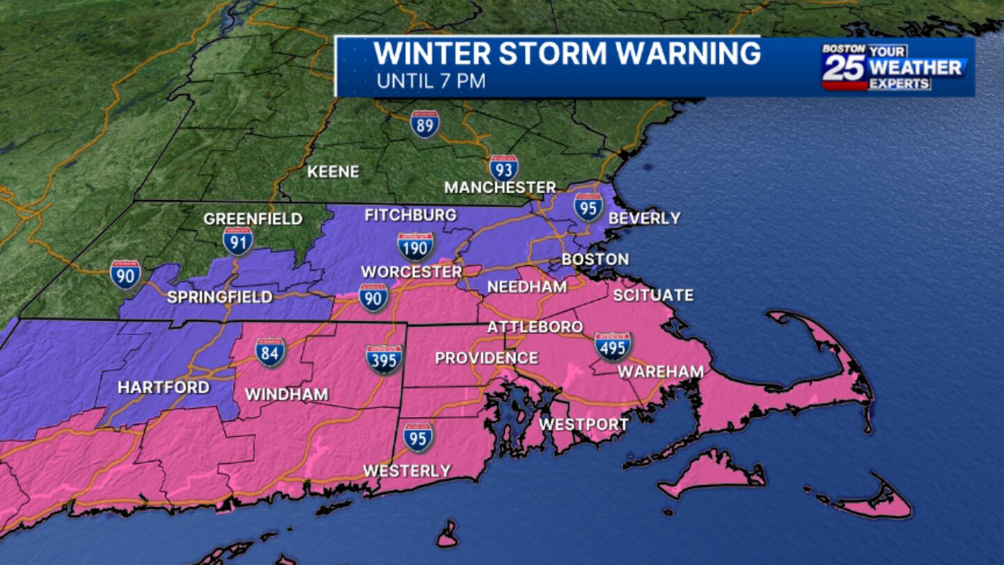
The National Weather Service has issued winter storm, high wind, and coastal flood warnings across the Bay State.
More than 300 schools canceled classes and Gov. Maura Healey directed about 22,000 non-essential state employees to stay home.
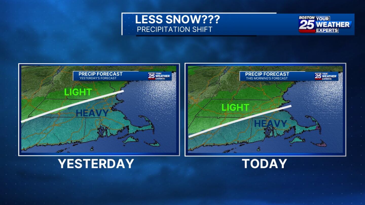
A southward shift in the track of this winter storm resulted in a drop in expected snow totals, but the Boston 25 Weather team is still forecasting a nasty afternoon, especially in southeastern Massachusetts.
“There has been a shift in the last 24 hours and that has lowered totals. We’re expecting a storm, we’re still expecting a period of heavy and steady snow from late morning into the afternoon, which is going to slow down travel, but the greatest impacts are going to be focused across southeastern Massachusetts,” Boston 25 Meteorologist Shiri Spear said in her Tuesday morning forecast.
A storm shift means totals have dropped quite a bit in the last 24 hours. We're still expecting a nasty afternoon, especially in southeastern MA. Storm will end by 6 PM on #CapeCod. @boston25 #mawx #newengland pic.twitter.com/LVtGt26axj
— Shiri Spear (@ShiriSpear) February 13, 2024
TIMELINE
Snowflakes started flying in Rhode Island and Connecticut early Tuesday and will push north and east into Massachusetts for the morning commute. Snow will persist in some areas through the evening drive.
- 7 a.m. -- Snow fills in from Worcester to Boston to New Bedford
- Noon -- Heaviest leg of snow and significant accumulation in southeastern Massachusetts through the early afternoon
- 2 p.m. -- Snow ends in Worcester
- 3/4 p.m. -- Snow winds down in Boston
- 5 p.m. -- Steady snow wraps up in the Plymouth area
- 6/7 p.m. -- Cape Cod and the Islands finally see clearing
“After that [6 p.m.] we might have a light snowband come through, but the steady stuff is going to be over and done. This is a pretty fast-moving storm system,” Spear said.
Snow is starting first in RI and CT and will work its way north and east during the morning commute. @Boston25 pic.twitter.com/cQrib0wDpM
— Shiri Spear (@ShiriSpear) February 13, 2024
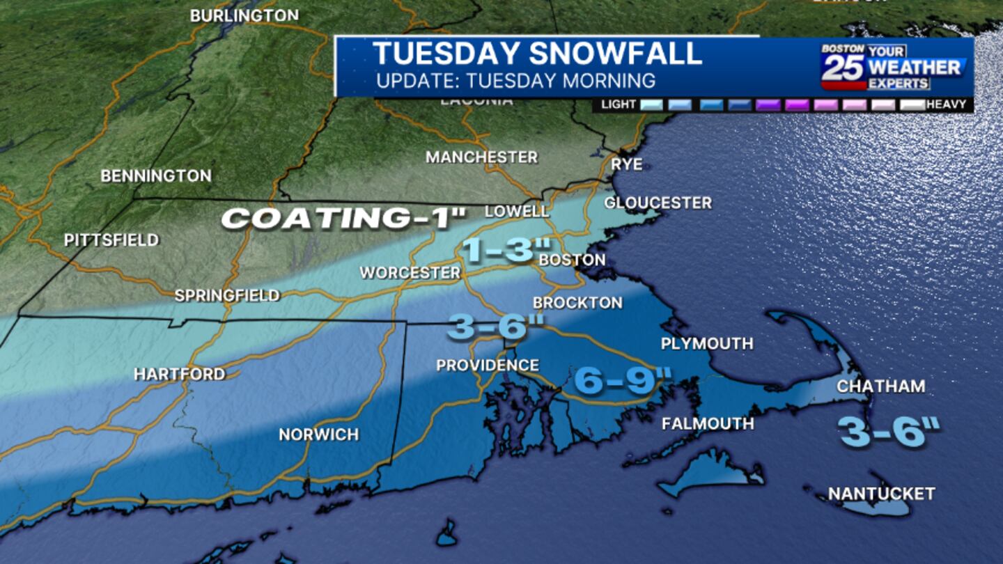
UPDATED EXPECTED SNOW TOTALS
- “Jackpot” area -- Southeastern Massachusetts, including parts of Cape Cod and the Islands: 6-9 inches
“Initially you guys [southeastern Mass.] see some mixing or some rain, but we’re still looking at the potential of 1 or 2 inches of snow per hour at times,” Spear said. “Visibility is going to be another concern on top of that.”
- Boston -- Right on the line separating snow bands of 1-3 inches and 3-6 inches
- North of the Mass. Pike, including Merrimack Valley and North Shore: 1-3 inches of snow
- South of Mass. Pike: 3-6 inches of snow
- Worcester: 1-3 inches of snow
- Parts of western Mass. -- coating to 3 inches of snow
ADDITIONAL STORM THREATS
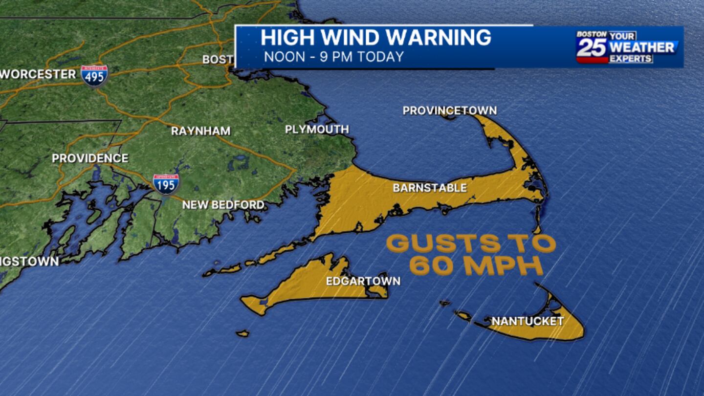
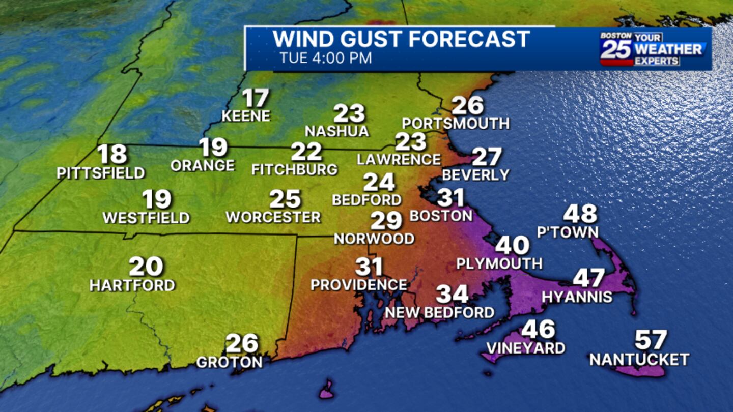
- High wind warning: A high wind warning for Cape Cod and the Islands. The warning is in effect for Barnstable, Dukes, and Nantucket counties from 7 a.m. to 10 p.m. Tuesday. Gusts of up to 60 mph are possible in the impacted areas.
- Coastal flood warning: Towns and cities along the coast of Massachusetts are also bracing for flooding. A coastal flooding warning is in effect for Barnstable, Dukes, Norfolk, Plymouth, Nantucket, and Suffolk counties from noon to 5 p.m. on Tuesday.
LATEST MAPS
Stay with the Boston 25 Weather Team for updates as the storm develops.
This is a developing story. Check back for updates as more information becomes available.
Download the FREE Boston 25 News app for breaking news alerts.
Follow Boston 25 News on Facebook and Twitter. | Watch Boston 25 News NOW
©2024 Cox Media Group

