BOSTON — We’re on a SEVERE WEATHER ALERT from the Boston 25 Weather Team due to a severe thunderstorm warning in our area.
This alert is in effect for East Central Cheshire and Southwestern Hillsboro counties in New Hampshire until 3:45 p.m.
Impacted areas include Merrimack, Bedford, Milford, Amherst, Hollis, Peterborough, New Boston, Antrim, Mont Vernon, Greenfield, Lyndeborough, Dublin, Francestown, Bennington, Harrisville, Nelson, Hancock, Goffstown, Mount Vernon, and Wilton.
A Severe Thunderstorm Warning is in effect for parts of our area until 8/05 3:45PM. Seek shelter immediately and stay with Boston 25 for the latest weather information. pic.twitter.com/D0rSENl27w
— Vicki Graf (@VickiGrafWX) August 5, 2024
Hail damage to vehicles is expected, the National Weather Service warned. Expect wind damage to roofs, siding, and trees.
“For your protection move to an interior room on the lowest floor of a building,” the NWS said in a statement.
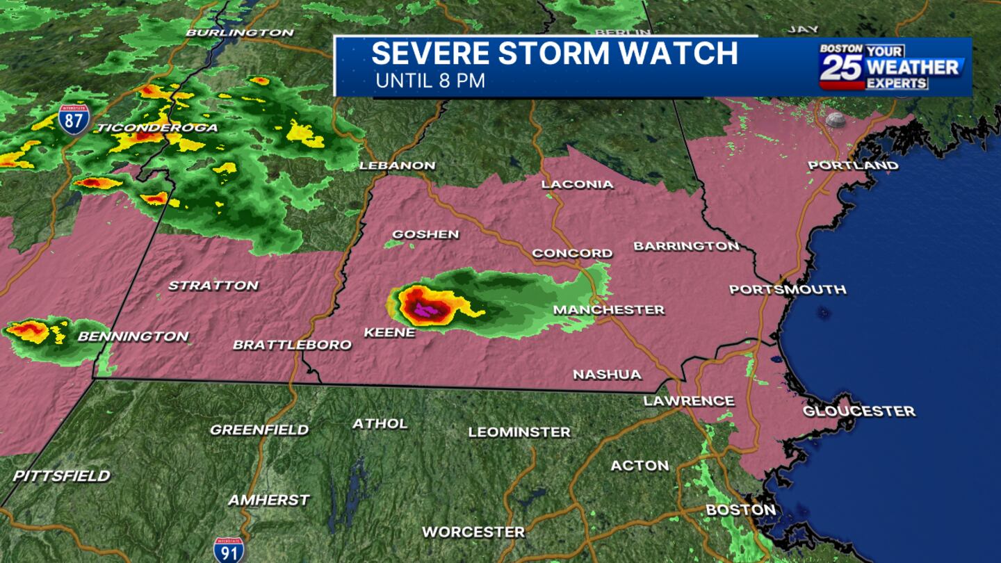
Parts of Essex County in Massachusetts, including Gloucester and Lawrence, are under a severe thunderstorm watch until 8 p.m. The watch also impacts Belknap, Cheshire, Hillsboro, Merrimack, Rockingham, Strafford, and Sullivan counties in New Hampshire.
WATCH THE FORECAST | INTERACTIVE RADAR | DOWNLOAD THE APPS
Follow our Boston 25 Meteorologists on Twitter for updates:
Kevin Lemanowicz | Shiri Spear | Tucker Antico | Vicki Graf
Stay Informed:
Utilize MEMA’s real-time power outage viewer to stay informed about current power outages in your community and region, and across the state, including information from utility companies about restoration times.
Utilize MEMA’s live weather radar and forecasting tools.
MassDOT | MBTA | Logan Airport | Amtrak
Online Resources:
Massachusetts Emergency Management Agency - on Facebook and Twitter
Federal Emergency Management Agency
National Weather Service/Boston
National Weather Service/Albany, NY
©2022 Cox Media Group