DEDHAM, Mass. — An April nor’easter will move into New England midweek, bringing heavy snow, soaking rain, and powerful wind gusts to the region, while also threatening power outages and coastal flooding.
Low-impact showers will begin to move across Massachusetts on Tuesday afternoon with rain, snow, and wind peaking Wednesday night into Thursday morning.
“Our peak storm is set for Wednesday night into Thursday morning with rain, snow, and wind,” Boston 25 Meteorologist Shiri Spear said in her latest weather forecast. “We really don’t have sunshine back in the forecast until Sunday afternoon.”
Wednesday morning will start with scattered, lighter showers with precipitation turning heavier and steadier on Wednesday afternoon. The storm will then peak overnight into Thursday with snow filling in many areas.
“Although it’s mainly rain in the greater Boston area, there may be some mixing with snow at times. The best chance for snow/sleet accumulations will be at elevations like the northern Worcester Hills, Berkshires, and Monadnocks,” Spear wrote in her latest weather blog. “Thursday morning’s commute in particular will be snowy and slick in those spots.”
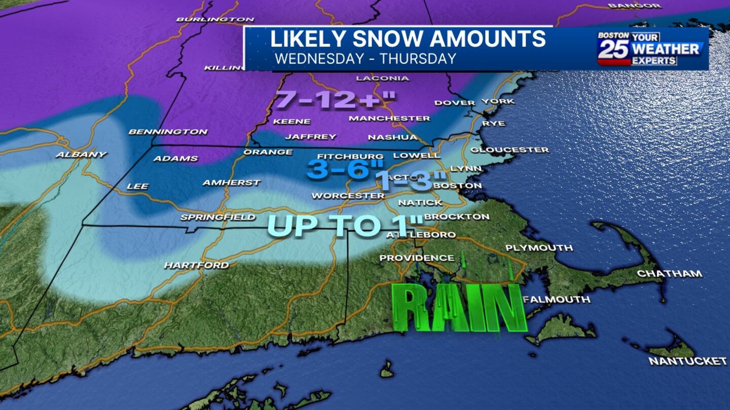
Parts of Massachusetts, including Berkshire County and the Fitchburg area could see up to 6 inches of snow.
The National Weather Service has issued a Winter Storm Watch for North Berkshire, Western Franklin, and Western Hampshire counties in Massachusetts from Wednesday morning through late Thursday night due to the chance for heavy snowfall and light ice accumulation.
Up to 3 inches of snow is possible across the northern Worcester Hills, Berkshires, and Monadnocks. Points to the south including Boston and the North Shore will likely see less than 1 inch of snow.
Plain rain is on tap for the South Shore, South Coast, Cape Cod, and the Islands.
More than a foot of snow is possible for parts of New Hampshire and Vermont.
“Going north and west of about the Fitchburg area, you can see we get into 3-6 [inches],” Spear said. “North and west of Keene, 6-12 [inches], with parts of ski country getting a foot and a half of snow.”
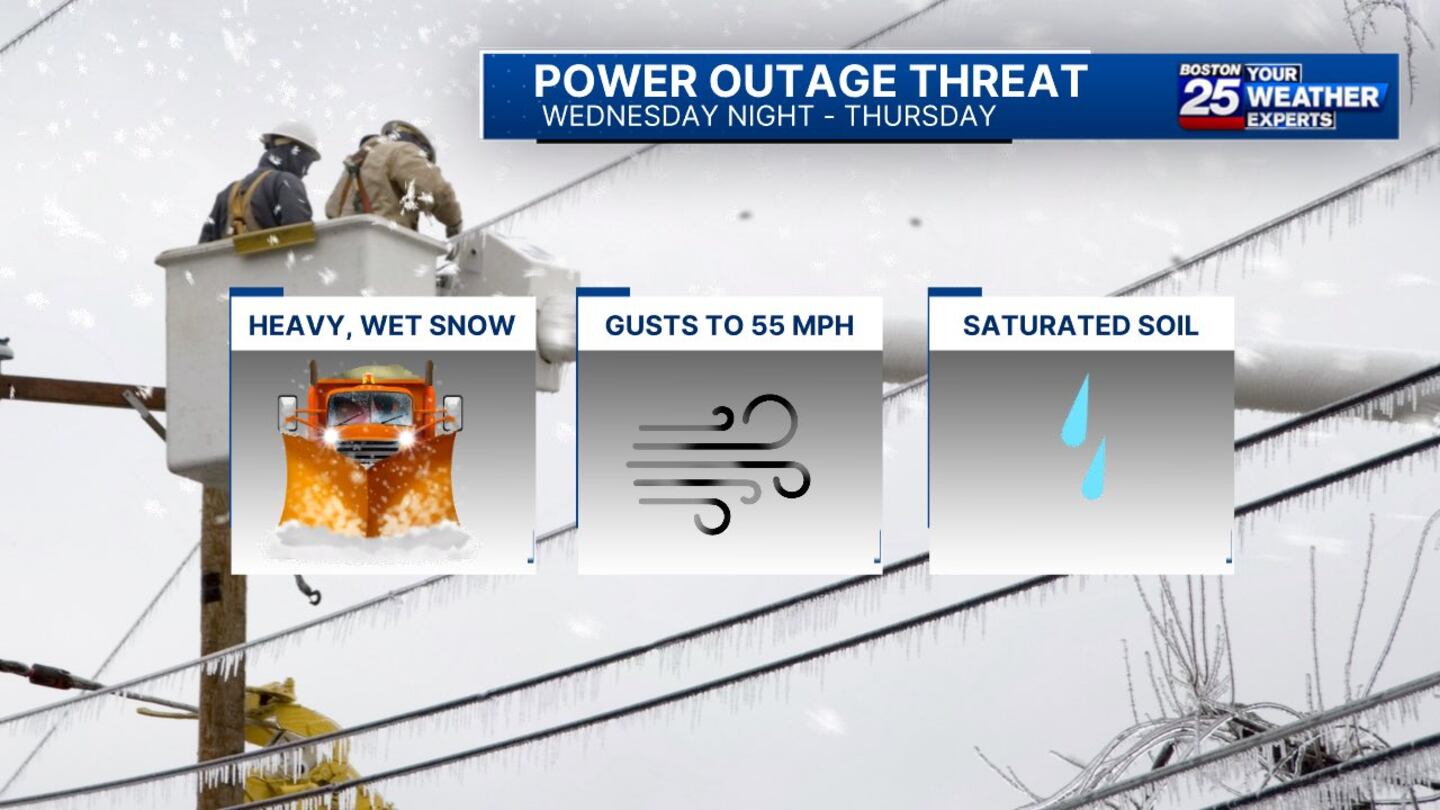
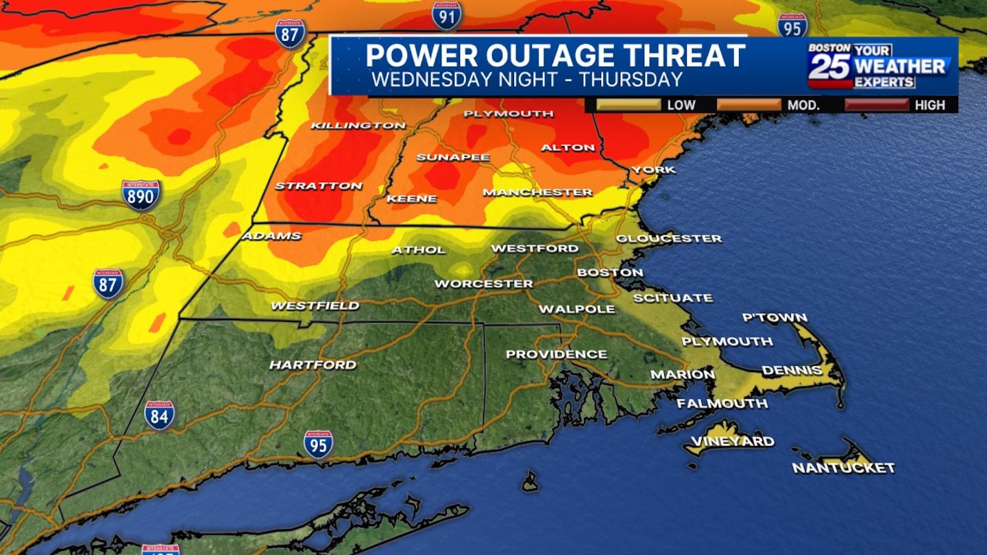
Expected heavy, wet snowfall in central and northern New England could cause power outages on Wednesday night when wind gusts could reach 45-55 mph.
“The greatest threat for power outages between Wednesday night and Thursday is where we get those high-end snowfall totals weighing down tree limbs and branches,” Spear said.
An expected 1-3 inches of rain could push rivers high again and minor to moderate flooding along the coast is possible when high tide hits. Waves up to 15 feet might also produce minor beach erosion.
For the latest forecast updates, visit the Boston 25 Weather page.
Download the FREE Boston 25 News app for breaking news alerts.
Follow Boston 25 News on Facebook and Twitter. | Watch Boston 25 News NOW
©2024 Cox Media Group


